
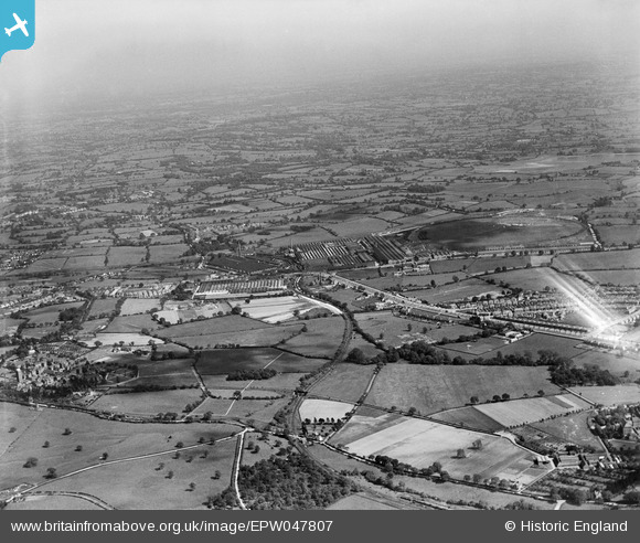
EPW047807 ENGLAND (1935). Longbridge Motor Works, Longbridge, from the north-west, 1935
© Copyright OpenStreetMap contributors and licensed by the OpenStreetMap Foundation. 2026. Cartography is licensed as CC BY-SA.
Nearby Images (3)
EPW047807

EPW047808

EPW047803

Details
| Title | [EPW047807] Longbridge Motor Works, Longbridge, from the north-west, 1935 |
| Reference | EPW047807 |
| Date | June-1935 |
| Link | |
| Place name | LONGBRIDGE |
| Parish | |
| District | |
| Country | ENGLAND |
| Easting / Northing | 400013, 277937 |
| Longitude / Latitude | -1.9998089130931, 52.399069298439 |
| National Grid Reference | SP000779 |
Pins

Stevel |
Monday 25th of May 2020 06:40:56 PM | |
|
harry |
Monday 15th of June 2015 11:08:37 PM | |
|
PURCELL |
Sunday 6th of April 2014 10:01:23 AM | |
|
PURCELL |
Sunday 6th of April 2014 09:59:47 AM | |
|
PURCELL |
Sunday 6th of April 2014 09:59:20 AM |