
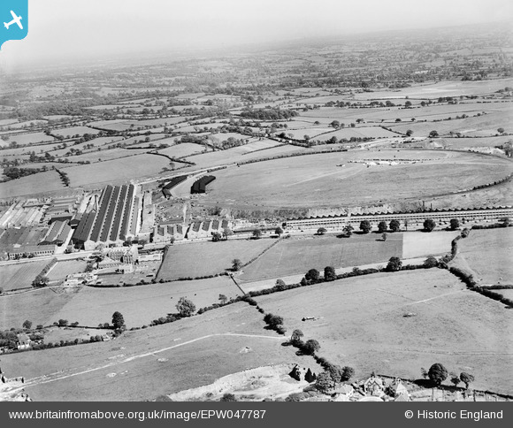
EPW047787 ENGLAND (1935). Longbridge Motor Works, Longbridge, from the north-west, 1935
© Copyright OpenStreetMap contributors and licensed by the OpenStreetMap Foundation. 2026. Cartography is licensed as CC BY-SA.
Nearby Images (5)
EPW047787

EPW047812

EPW047784

EPW010507

EPW047810

Details
| Title | [EPW047787] Longbridge Motor Works, Longbridge, from the north-west, 1935 |
| Reference | EPW047787 |
| Date | June-1935 |
| Link | |
| Place name | LONGBRIDGE |
| Parish | |
| District | |
| Country | ENGLAND |
| Easting / Northing | 400400, 277252 |
| Longitude / Latitude | -1.994121221353, 52.392910224493 |
| National Grid Reference | SP004773 |
Pins

emu-star |
Thursday 14th of November 2013 09:42:02 PM | |
|
emu-star |
Thursday 14th of November 2013 09:34:06 PM |