
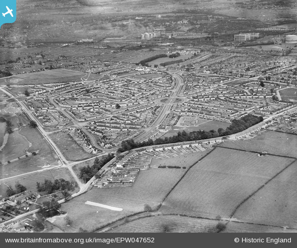
EPW047652 ENGLAND (1935). Housing development at Hallam Crescent East and Coalpit Lane and environs, Braunstone Park, 1935
© Copyright OpenStreetMap contributors and licensed by the OpenStreetMap Foundation. 2026. Cartography is licensed as CC BY-SA.
Nearby Images (4)
EPW047652

EPW047653

EPW047650

EPW047651

Details
| Title | [EPW047652] Housing development at Hallam Crescent East and Coalpit Lane and environs, Braunstone Park, 1935 |
| Reference | EPW047652 |
| Date | June-1935 |
| Link | |
| Place name | BRAUNSTONE PARK |
| Parish | |
| District | |
| Country | ENGLAND |
| Easting / Northing | 456295, 302573 |
| Longitude / Latitude | -1.1683972538943, 52.617651913922 |
| National Grid Reference | SK563026 |
Pins

yogi |
Monday 13th of February 2017 12:19:19 AM | |
|
yogi |
Monday 13th of February 2017 12:18:03 AM | |
|
yogi |
Monday 13th of February 2017 12:18:02 AM | |
|
yogi |
Monday 13th of February 2017 12:16:01 AM | |
|
yogi |
Monday 13th of February 2017 12:10:17 AM | |
|
yogi |
Saturday 25th of June 2016 04:32:00 PM | |
|
Tony |
Monday 23rd of December 2013 01:14:47 PM | |
|
Tony |
Monday 23rd of December 2013 01:14:18 PM | |
|
Tony |
Monday 23rd of December 2013 01:13:48 PM | |
|
Tony |
Monday 23rd of December 2013 01:13:13 PM |