
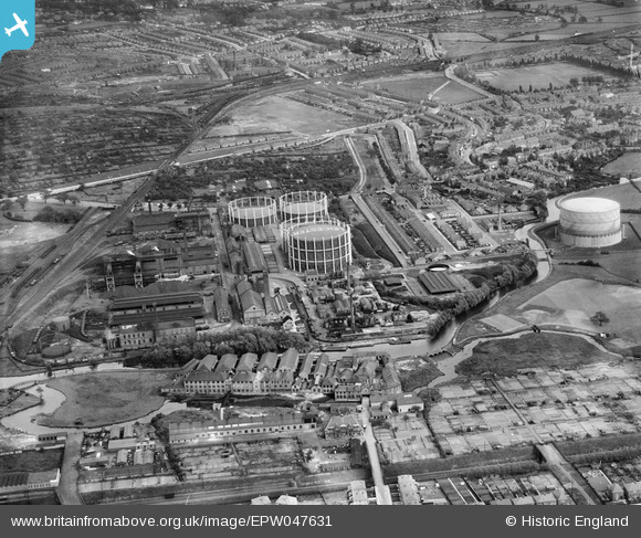
EPW047631 ENGLAND (1935). Leicester Corporation Gas Works and environs, Leicester, 1935
© Copyright OpenStreetMap contributors and licensed by the OpenStreetMap Foundation. 2026. Cartography is licensed as CC BY-SA.
Nearby Images (10)
EPW047631

EPW047633

EPW035990

EPW047629

EPW047634

EPW005101

EPW047636

EPW035989

EPW047630

EPW047632

Details
| Title | [EPW047631] Leicester Corporation Gas Works and environs, Leicester, 1935 |
| Reference | EPW047631 |
| Date | June-1935 |
| Link | |
| Place name | LEICESTER |
| Parish | |
| District | |
| Country | ENGLAND |
| Easting / Northing | 457929, 302428 |
| Longitude / Latitude | -1.1442877347084, 52.616176510223 |
| National Grid Reference | SK579024 |


