
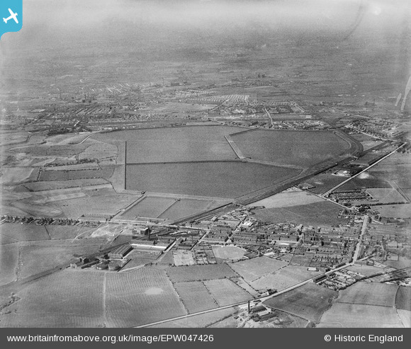
EPW047426 ENGLAND (1935). Audenshaw Reservoirs and environs, Audenshaw, from the south, 1935
© Copyright OpenStreetMap contributors and licensed by the OpenStreetMap Foundation. 2026. Cartography is licensed as CC BY-SA.
Nearby Images (4)
EPW047426

EPW047423

EPW047424

EPW047422

Details
| Title | [EPW047426] Audenshaw Reservoirs and environs, Audenshaw, from the south, 1935 |
| Reference | EPW047426 |
| Date | May-1935 |
| Link | |
| Place name | AUDENSHAW |
| Parish | |
| District | |
| Country | ENGLAND |
| Easting / Northing | 391479, 395583 |
| Longitude / Latitude | -2.1283404974807, 53.45667644114 |
| National Grid Reference | SJ915956 |
Pins
Be the first to add a comment to this image!