
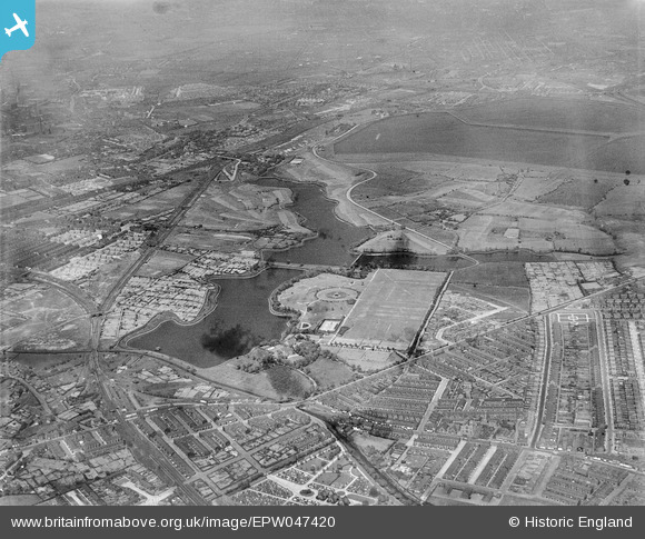
EPW047420 ENGLAND (1935). Gorton Upper and Lower Reservoirs and environs, Gorton, 1935
© Copyright OpenStreetMap contributors and licensed by the OpenStreetMap Foundation. 2026. Cartography is licensed as CC BY-SA.
Nearby Images (8)
EPW047420

EPW047413

EPW047417

EPW047415

EPW047419

EPW047418

EPW047414

EPW047416

Details
| Title | [EPW047420] Gorton Upper and Lower Reservoirs and environs, Gorton, 1935 |
| Reference | EPW047420 |
| Date | May-1935 |
| Link | |
| Place name | GORTON |
| Parish | |
| District | |
| Country | ENGLAND |
| Easting / Northing | 389954, 396250 |
| Longitude / Latitude | -2.1513307827411, 53.46264555328 |
| National Grid Reference | SJ900963 |
Pins

Buzzer |
Wednesday 3rd of June 2020 06:48:28 PM | |
|
Buzzer |
Wednesday 3rd of June 2020 06:47:40 PM | |
|
Buzzer |
Wednesday 3rd of June 2020 06:46:03 PM | |

Class31 |
Monday 21st of October 2013 12:09:34 AM | |
|
Class31 |
Monday 21st of October 2013 12:05:48 AM | |
|
Class31 |
Monday 21st of October 2013 12:02:17 AM | |
|
Class31 |
Sunday 20th of October 2013 11:55:49 PM |