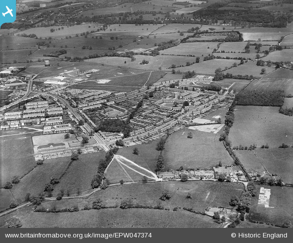
EPW047374 ENGLAND (1935). Ludwick Way, housing around Cranborne Gardens, Shortlands Green and environs, Welwyn Garden City, 1935
© Copyright OpenStreetMap contributors and licensed by the OpenStreetMap Foundation. 2026. Cartography is licensed as CC BY-SA.
Nearby Images (6)
Details
| Title | [EPW047374] Ludwick Way, housing around Cranborne Gardens, Shortlands Green and environs, Welwyn Garden City, 1935 |
| Reference | EPW047374 |
| Date | May-1935 |
| Link | |
| Place name | WELWYN GARDEN CITY |
| Parish | |
| District | |
| Country | ENGLAND |
| Easting / Northing | 524861, 212303 |
| Longitude / Latitude | -0.18922406080753, 51.794972234077 |
| National Grid Reference | TL249123 |
Pins
Be the first to add a comment to this image!


![[EPW047374] Ludwick Way, housing around Cranborne Gardens, Shortlands Green and environs, Welwyn Garden City, 1935](http://britainfromabove.org.uk/sites/all/libraries/aerofilms-images/public/100x100/EPW/047/EPW047374.jpg)
![[EPW047371] Housing around Cranborne Gardens and Shortlands Green, Welwyn Garden City, 1935](http://britainfromabove.org.uk/sites/all/libraries/aerofilms-images/public/100x100/EPW/047/EPW047371.jpg)
![[EPW047373] Housing around Cranborne Gardens, Shortlands Green and environs, Welwyn Garden City, 1935](http://britainfromabove.org.uk/sites/all/libraries/aerofilms-images/public/100x100/EPW/047/EPW047373.jpg)
![[EPW047372] Housing around Cranborne Gardens and Shortlands Green, Welwyn Garden City, 1935](http://britainfromabove.org.uk/sites/all/libraries/aerofilms-images/public/100x100/EPW/047/EPW047372.jpg)
![[EAW041978] The Peartree area and environs, Peartree, 1952](http://britainfromabove.org.uk/sites/all/libraries/aerofilms-images/public/100x100/EAW/041/EAW041978.jpg)
![[EPW054541] The residential area surrounding Verulam Close, Cranborne Gardens and Shortlands Green, Peartree, 1937](http://britainfromabove.org.uk/sites/all/libraries/aerofilms-images/public/100x100/EPW/054/EPW054541.jpg)