
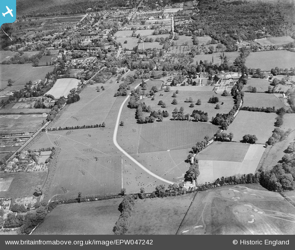
EPW047242 ENGLAND (1935). Farnham Chase House and surrounding countryside, Farnham Royal, 1935
© Copyright OpenStreetMap contributors and licensed by the OpenStreetMap Foundation. 2025. Cartography is licensed as CC BY-SA.
Nearby Images (5)
EPW047242

EPW047240

EPW047243

EPW047239

EPW047241

Details
| Title | [EPW047242] Farnham Chase House and surrounding countryside, Farnham Royal, 1935 |
| Reference | EPW047242 |
| Date | May-1935 |
| Link | |
| Place name | FARNHAM ROYAL |
| Parish | FARNHAM ROYAL |
| District | |
| Country | ENGLAND |
| Easting / Northing | 496346, 183470 |
| Longitude / Latitude | -0.61056026303269, 51.541416028753 |
| National Grid Reference | SU963835 |
Pins
Be the first to add a comment to this image!