
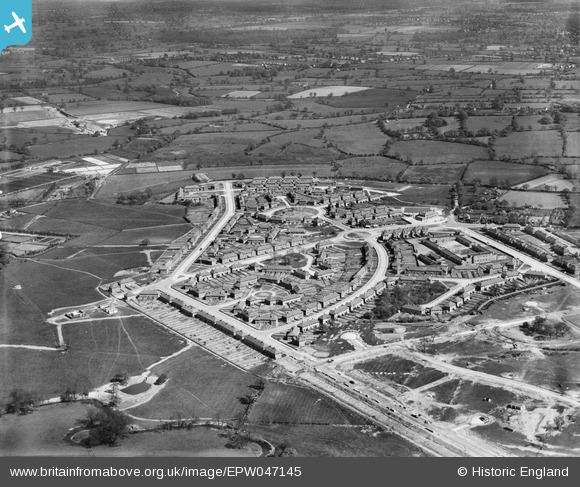
EPW047145 ENGLAND (1935). The residential area surrounding Hollington Crescent and Glebe Farm Road, Stechford, 1935
© Copyright OpenStreetMap contributors and licensed by the OpenStreetMap Foundation. 2025. Cartography is licensed as CC BY-SA.
Nearby Images (12)
EPW047145

EPW047139

EPW047143

EPW047141

EPW047146

EPW047138

EPW047144

EPW047142

EPW047148

EAW001179

EAW001174

EAW001175

Details
| Title | [EPW047145] The residential area surrounding Hollington Crescent and Glebe Farm Road, Stechford, 1935 |
| Reference | EPW047145 |
| Date | May-1935 |
| Link | |
| Place name | STECHFORD |
| Parish | |
| District | |
| Country | ENGLAND |
| Easting / Northing | 414163, 287974 |
| Longitude / Latitude | -1.7913930812854, 52.489128706242 |
| National Grid Reference | SP142880 |
Pins
Be the first to add a comment to this image!