
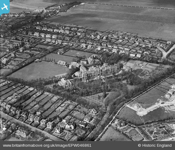
EPW046861 ENGLAND (1935). The Thomas More Catholic School formerly the Warehousemen Clerks and Drapers' Schools and the surrounding residential area, Russell Hill, 1935
© Copyright OpenStreetMap contributors and licensed by the OpenStreetMap Foundation. 2026. Cartography is licensed as CC BY-SA.
Nearby Images (11)
EPW046861

EPW005193

EPW005197

EPW005195

EPW046858

EPW005196

EPW046860

EPW046859

EPW046857

EPW046868

EPW005194

Details
| Title | [EPW046861] The Thomas More Catholic School formerly the Warehousemen Clerks and Drapers' Schools and the surrounding residential area, Russell Hill, 1935 |
| Reference | EPW046861 |
| Date | April-1935 |
| Link | |
| Place name | RUSSELL HILL |
| Parish | |
| District | |
| Country | ENGLAND |
| Easting / Northing | 531067, 162149 |
| Longitude / Latitude | -0.11798540685094, 51.342793184751 |
| National Grid Reference | TQ311621 |
Pins
Be the first to add a comment to this image!