
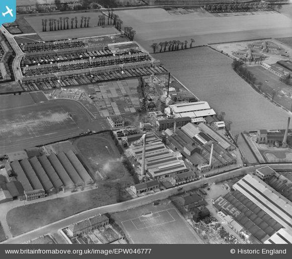
EPW046777 ENGLAND (1935). The Ship Carbon Co Works, Little Heath, 1935
© Copyright OpenStreetMap contributors and licensed by the OpenStreetMap Foundation. 2026. Cartography is licensed as CC BY-SA.
Nearby Images (27)
EPW046777

EPW046778

EPW046779

EPW046783

EPW046781

EPW046780

EPW046782

EAW020749

EAW020752

EAW020751

EAW020748

EAW020743

EAW020750

EAW020744

EAW020747

EPW046786

EAW020746

EPW046796

EPW046787

EPW046792

EPW051564

EAW020745

EPW046784

EPW046785

EPW051561

EPW046791

EPW051557

Details
| Title | [EPW046777] The Ship Carbon Co Works, Little Heath, 1935 |
| Reference | EPW046777 |
| Date | April-1935 |
| Link | |
| Place name | LITTLE HEATH |
| Parish | |
| District | |
| Country | ENGLAND |
| Easting / Northing | 546934, 188289 |
| Longitude / Latitude | 0.12055631824816, 51.573818247925 |
| National Grid Reference | TQ469883 |
Pins
Be the first to add a comment to this image!