
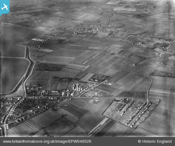
EPW046526 ENGLAND (1935). Land to the east of the Staines Reservoirs, Stanwell, 1935
© Copyright OpenStreetMap contributors and licensed by the OpenStreetMap Foundation. 2026. Cartography is licensed as CC BY-SA.
Nearby Images (4)
EPW046526

EPW046527

EPW046528

EPW046529

Details
| Title | [EPW046526] Land to the east of the Staines Reservoirs, Stanwell, 1935 |
| Reference | EPW046526 |
| Date | February-1935 |
| Link | |
| Place name | STANWELL |
| Parish | |
| District | |
| Country | ENGLAND |
| Easting / Northing | 506331, 173266 |
| Longitude / Latitude | -0.46969104934463, 51.447896060526 |
| National Grid Reference | TQ063733 |
Pins

Bob Dick |
Friday 28th of January 2022 07:44:33 PM | |
|
Bob Dick |
Friday 28th of January 2022 07:43:36 PM | |
|
RichardFarrar |
Monday 17th of August 2020 07:58:31 PM | |
|
RichardFarrar |
Monday 17th of August 2020 07:56:12 PM | |
|
RichardFarrar |
Monday 17th of August 2020 07:53:57 PM | |
|
RichardFarrar |
Monday 17th of August 2020 07:49:43 PM | |

Class31 |
Tuesday 15th of September 2015 04:24:03 PM | |
|
markhortonphotography |
Sunday 26th of January 2014 09:22:24 PM | |
|
markhortonphotography |
Sunday 26th of January 2014 09:21:01 PM | |
|
markhortonphotography |
Sunday 26th of January 2014 09:07:37 PM | |
|
markhortonphotography |
Sunday 26th of January 2014 09:07:11 PM | |
|
markhortonphotography |
Sunday 26th of January 2014 08:53:06 PM | |
|
markhortonphotography |
Sunday 26th of January 2014 08:52:35 PM | |
|
markhortonphotography |
Sunday 26th of January 2014 08:52:02 PM |

User Comment Contributions
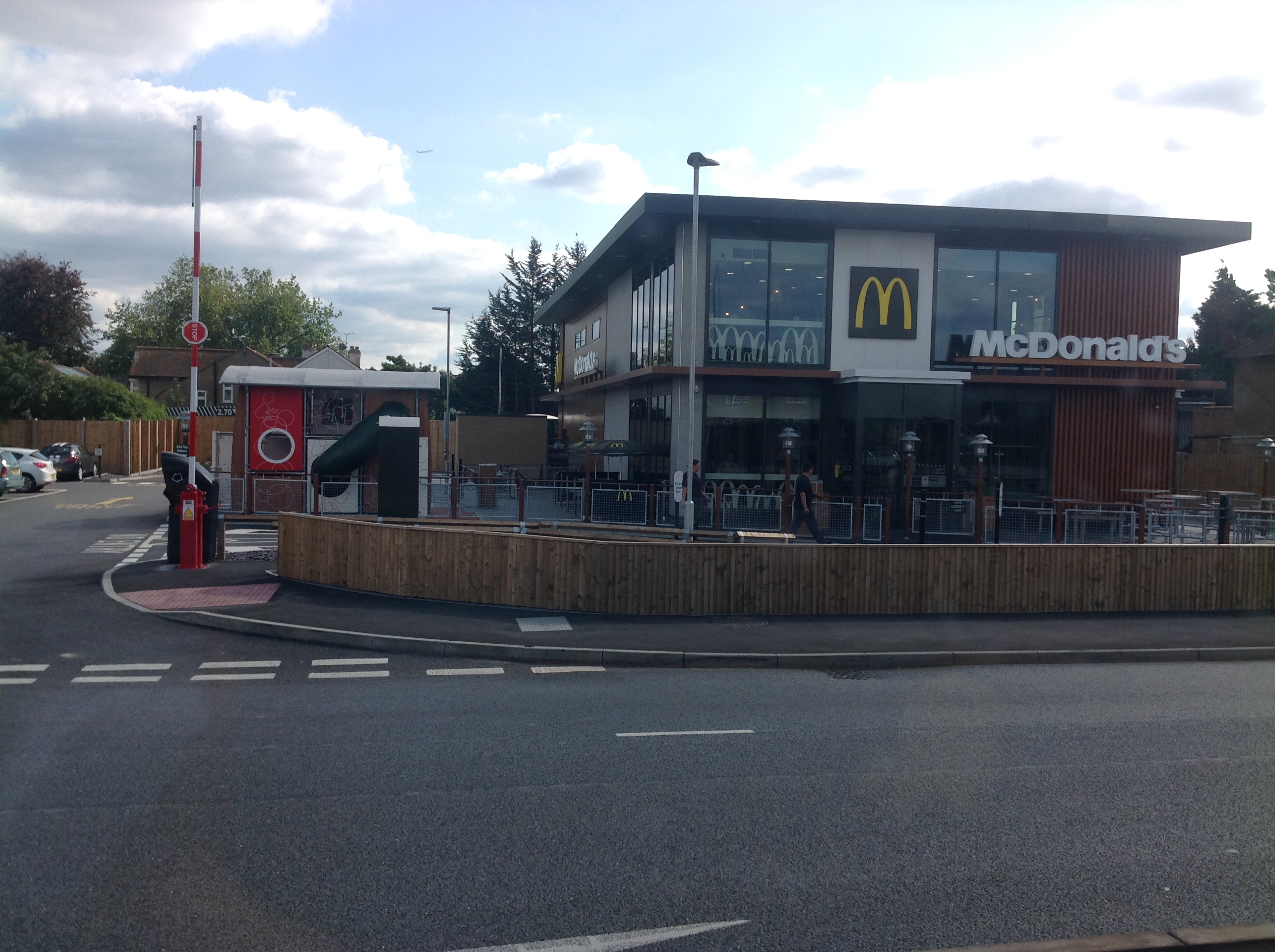
London Road at Stanwell Road, Ashford, 07/09/2015 |
Class31 |
Tuesday 15th of September 2015 04:24:32 PM |