
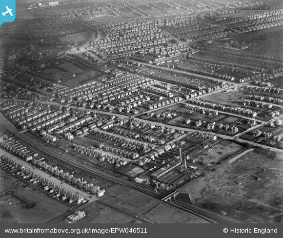
EPW046511 ENGLAND (1935). Residential area surrounding Melton Road and Burleigh Road and the Ludlow Hill Brick Works, West Bridgford, 1935
© Copyright OpenStreetMap contributors and licensed by the OpenStreetMap Foundation. 2026. Cartography is licensed as CC BY-SA.
Nearby Images (2)
EPW046511

EPW046514

Details
| Title | [EPW046511] Residential area surrounding Melton Road and Burleigh Road and the Ludlow Hill Brick Works, West Bridgford, 1935 |
| Reference | EPW046511 |
| Date | February-1935 |
| Link | |
| Place name | WEST BRIDGFORD |
| Parish | |
| District | |
| Country | ENGLAND |
| Easting / Northing | 458854, 336707 |
| Longitude / Latitude | -1.1244650362372, 52.924228895746 |
| National Grid Reference | SK589367 |
Pins

MML |
Tuesday 7th of July 2020 12:03:52 PM | |
|
MML |
Tuesday 10th of March 2020 01:57:38 PM | |
|
MML |
Tuesday 10th of March 2020 01:56:53 PM | |
|
MML |
Tuesday 10th of March 2020 01:55:33 PM | |
|
MML |
Monday 3rd of June 2019 03:07:31 PM | |
|
MML |
Monday 3rd of June 2019 03:06:56 PM | |
|
MML |
Monday 3rd of June 2019 03:06:33 PM | |
|
MML |
Monday 3rd of June 2019 03:06:00 PM | |
|
MML |
Monday 3rd of June 2019 03:05:14 PM | |
|
MML |
Friday 19th of April 2019 08:58:12 AM | |
|
Dom Sweeney |
Monday 21st of October 2013 08:13:00 PM |