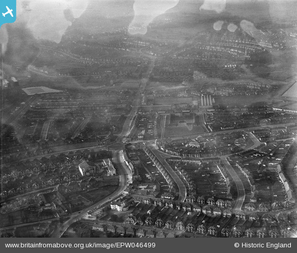
EPW046499 ENGLAND (1935). Neasden Lane and environs, Neasden, from the south-east, 1935
© Copyright OpenStreetMap contributors and licensed by the OpenStreetMap Foundation. 2025. Cartography is licensed as CC BY-SA.
Nearby Images (7)
Details
| Title | [EPW046499] Neasden Lane and environs, Neasden, from the south-east, 1935 |
| Reference | EPW046499 |
| Date | January-1935 |
| Link | |
| Place name | NEASDEN |
| Parish | |
| District | |
| Country | ENGLAND |
| Easting / Northing | 521335, 186053 |
| Longitude / Latitude | -0.24945622158424, 51.559813103272 |
| National Grid Reference | TQ213861 |
Pins

Ian K |
Monday 30th of November 2015 09:57:02 AM | |

Class31 |
Monday 13th of October 2014 11:58:02 AM | |

Class31 |
Sunday 2nd of March 2014 11:42:14 PM | |

Class31 |
Sunday 2nd of March 2014 11:19:19 PM | |

Class31 |
Sunday 2nd of March 2014 11:18:11 PM | |

Class31 |
Sunday 2nd of March 2014 11:17:40 PM | |

Class31 |
Sunday 2nd of March 2014 11:17:07 PM | |

Class31 |
Sunday 2nd of March 2014 11:15:45 PM | |

Class31 |
Sunday 2nd of March 2014 11:15:15 PM | |

Class31 |
Sunday 2nd of March 2014 11:14:58 PM | |

Class31 |
Sunday 2nd of March 2014 11:14:30 PM | |

Class31 |
Sunday 2nd of March 2014 11:14:07 PM |


![[EPW046499] Neasden Lane and environs, Neasden, from the south-east, 1935](http://britainfromabove.org.uk/sites/all/libraries/aerofilms-images/public/100x100/EPW/046/EPW046499.jpg)
![[EPW038695] The Circle and housing off the North Circular Road, Neasden, from the south-west, 1932. This image has been produced from a damaged negative.](http://britainfromabove.org.uk/sites/all/libraries/aerofilms-images/public/100x100/EPW/038/EPW038695.jpg)
![[EPW046504] Neasden Lane, the North Circular Road and environs, Neasden, from the south-east, 1935](http://britainfromabove.org.uk/sites/all/libraries/aerofilms-images/public/100x100/EPW/046/EPW046504.jpg)
![[EPW038698] The Circle and housing off the North Circular Road, Neasden, from the south-west, 1932](http://britainfromabove.org.uk/sites/all/libraries/aerofilms-images/public/100x100/EPW/038/EPW038698.jpg)
![[EPW038697] The Circle and housing off the North Circular Road, Neasden, from the south-west, 1932](http://britainfromabove.org.uk/sites/all/libraries/aerofilms-images/public/100x100/EPW/038/EPW038697.jpg)
![[EPW038696] The Brent Reservoir and housing off the North Circular Road, Neasden, from the south-west, 1932](http://britainfromabove.org.uk/sites/all/libraries/aerofilms-images/public/100x100/EPW/038/EPW038696.jpg)
![[EPW046497] Neasden Lane and environs, Neasden, from the south-east, 1935](http://britainfromabove.org.uk/sites/all/libraries/aerofilms-images/public/100x100/EPW/046/EPW046497.jpg)