
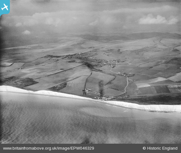
EPW046329 ENGLAND (1934). Birling Gap and the village, East Dean, from the south-west, 1934
© Copyright OpenStreetMap contributors and licensed by the OpenStreetMap Foundation. 2025. Cartography is licensed as CC BY-SA.
Nearby Images (3)
EPW046329

EPW044656

EPW046327

Details
| Title | [EPW046329] Birling Gap and the village, East Dean, from the south-west, 1934 |
| Reference | EPW046329 |
| Date | October-1934 |
| Link | |
| Place name | EAST DEAN |
| Parish | EAST DEAN AND FRISTON |
| District | |
| Country | ENGLAND |
| Easting / Northing | 555207, 96134 |
| Longitude / Latitude | 0.20009402542017, 50.743470619913 |
| National Grid Reference | TV552961 |
Pins

Alan McFaden |
Monday 14th of April 2014 09:23:15 AM | |
|
Alan McFaden |
Monday 14th of April 2014 09:22:20 AM | |

bescotbeast |
Wednesday 19th of March 2014 03:24:00 PM |

