
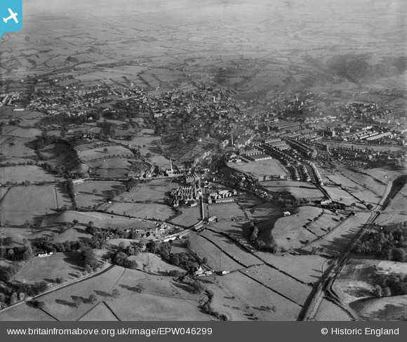
EPW046299 ENGLAND (1934). Macclesfield Road and the town, Leek, from the north-west, 1934
© Copyright OpenStreetMap contributors and licensed by the OpenStreetMap Foundation. 2026. Cartography is licensed as CC BY-SA.
Nearby Images (10)
EPW046299

EPW046314

EPW046302

EPW046300

EPW046301

EPW046304

EPW046313

EPW046309

EPW046303

EPW046305

Details
| Title | [EPW046299] Macclesfield Road and the town, Leek, from the north-west, 1934 |
| Reference | EPW046299 |
| Date | October-1934 |
| Link | |
| Place name | LEEK |
| Parish | LEEK |
| District | |
| Country | ENGLAND |
| Easting / Northing | 397310, 357050 |
| Longitude / Latitude | -2.0401896149758, 53.110335064039 |
| National Grid Reference | SJ973571 |
Pins

Angielahaha |
Monday 9th of January 2017 08:59:31 PM | |

bescotbeast |
Saturday 14th of September 2013 05:20:57 AM | |
|
IvanSherratt |
Monday 26th of August 2013 10:12:45 PM |