
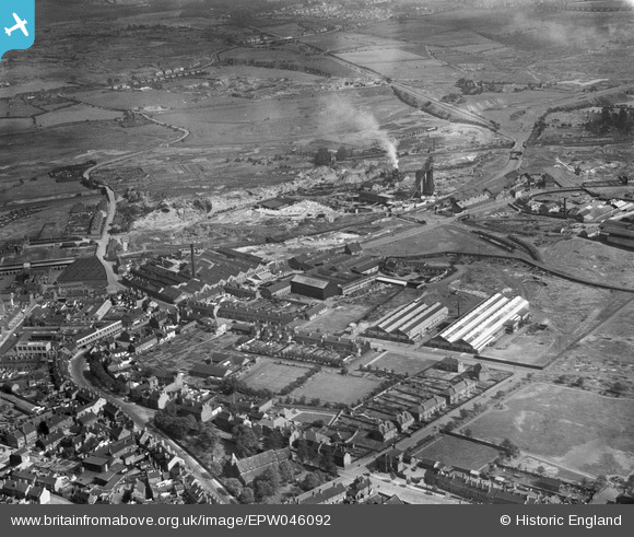
EPW046092 ENGLAND (1934). Richard Street, the Charles Richards and Sons Ltd Imperial Bolt and Nut Works and environs, Darlaston, 1934
© Copyright OpenStreetMap contributors and licensed by the OpenStreetMap Foundation. 2026. Cartography is licensed as CC BY-SA.
Nearby Images (24)
EPW046092

EAW007491

EPW046087

EPW046088

EPW046091

EPW046089

EAW007489

EAW007487

EPW046094

EAW007488

EAW007486

EAW007485

EPW046090

EPW046099

EPW046096

EPW046093

EAW007484

EAW007490

EAW007492

EPW046098

EPW046097

EPW046095

EAW007494

EAW007493

Details
| Title | [EPW046092] Richard Street, the Charles Richards and Sons Ltd Imperial Bolt and Nut Works and environs, Darlaston, 1934 |
| Reference | EPW046092 |
| Date | September-1934 |
| Link | |
| Place name | DARLASTON |
| Parish | |
| District | |
| Country | ENGLAND |
| Easting / Northing | 398054, 297605 |
| Longitude / Latitude | -2.0287191833264, 52.575900730655 |
| National Grid Reference | SO981976 |
