
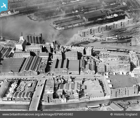
EPW045982 ENGLAND (1934). The Co-Operative Wholesale Society Sun Mills and environs, Trafford Park, 1934
© Copyright OpenStreetMap contributors and licensed by the OpenStreetMap Foundation. 2026. Cartography is licensed as CC BY-SA.
Nearby Images (13)
EPW045982

EPW045977

EPW045979

EPW017592

EPW045978

EPW045980

EPW045976

EPW017593

EPW017589

EPW017590

EPW017595

EPW045981

EPW027790
 and Salford Docks, Trafford Park, 1929. This image has been produced from a copy-negative.")
Details
| Title | [EPW045982] The Co-Operative Wholesale Society Sun Mills and environs, Trafford Park, 1934 |
| Reference | EPW045982 |
| Date | September-1934 |
| Link | |
| Place name | TRAFFORD PARK |
| Parish | |
| District | |
| Country | ENGLAND |
| Easting / Northing | 380946, 396590 |
| Longitude / Latitude | -2.2870445460555, 53.465453061526 |
| National Grid Reference | SJ809966 |
Pins

wadey |
Wednesday 23rd of April 2025 12:23:44 PM |