
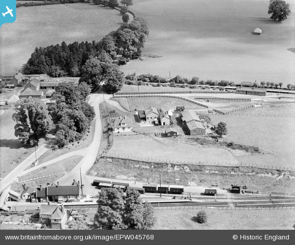
EPW045768 ENGLAND (1934). Wiltshire Creameries Ltd and Savernake Station, Burbage, 1934
© Copyright OpenStreetMap contributors and licensed by the OpenStreetMap Foundation. 2026. Cartography is licensed as CC BY-SA.
Nearby Images (6)
EPW045768

EPW045771

EPW045769

EPW045766

EPW045770

EPW045767

Details
| Title | [EPW045768] Wiltshire Creameries Ltd and Savernake Station, Burbage, 1934 |
| Reference | EPW045768 |
| Date | August-1934 |
| Link | |
| Place name | BURBAGE |
| Parish | BURBAGE |
| District | |
| Country | ENGLAND |
| Easting / Northing | 423676, 163292 |
| Longitude / Latitude | -1.6598606282787, 51.367697043474 |
| National Grid Reference | SU237633 |
Pins

SteveLoftus |
Sunday 28th of June 2020 03:45:48 PM | |
|
SteveLoftus |
Sunday 28th of June 2020 03:45:08 PM | |

Class31 |
Monday 5th of August 2013 10:01:06 AM |
