
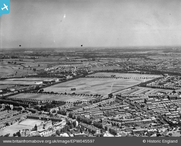
EPW045597 ENGLAND (1934). The Racecourse Recreation Ground, Northampton, from the south-west, 1934. This image has been produced from a damaged print.
© Copyright OpenStreetMap contributors and licensed by the OpenStreetMap Foundation. 2026. Cartography is licensed as CC BY-SA.
Nearby Images (2)
EPW045597

EPW034343

Details
| Title | [EPW045597] The Racecourse Recreation Ground, Northampton, from the south-west, 1934. This image has been produced from a damaged print. |
| Reference | EPW045597 |
| Date | July-1934 |
| Link | |
| Place name | NORTHAMPTON |
| Parish | |
| District | |
| Country | ENGLAND |
| Easting / Northing | 475544, 261377 |
| Longitude / Latitude | -0.89341249894408, 52.244987974252 |
| National Grid Reference | SP755614 |
