
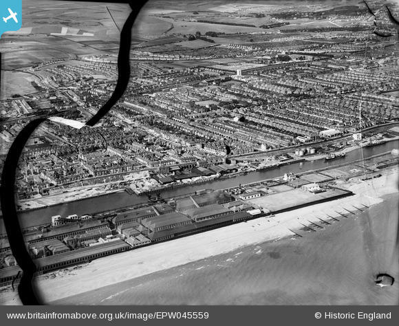
EPW045559 ENGLAND (1934). Tha Canal, Baltic Wharf and the town, Portslade-By-Sea, from the south-west, 1934. This image has been produced from a damaged negative.
© Copyright OpenStreetMap contributors and licensed by the OpenStreetMap Foundation. 2026. Cartography is licensed as CC BY-SA.
Nearby Images (4)
EPW045559

EPW054051

EPW018081

EPW041383

Details
| Title | [EPW045559] Tha Canal, Baltic Wharf and the town, Portslade-By-Sea, from the south-west, 1934. This image has been produced from a damaged negative. |
| Reference | EPW045559 |
| Date | July-1934 |
| Link | |
| Place name | PORTSLADE-BY-SEA |
| Parish | |
| District | |
| Country | ENGLAND |
| Easting / Northing | 526029, 104681 |
| Longitude / Latitude | -0.21033922184689, 50.827369914807 |
| National Grid Reference | TQ260047 |
Pins

micky |
Monday 28th of April 2014 03:52:08 PM |