
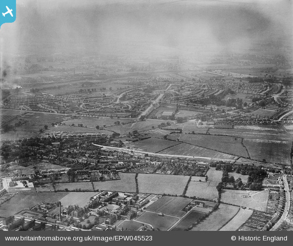
EPW045523 ENGLAND (1934). Fallings Park looking towards Showell Circus and Low Hill, Heath Town, from the south-east, 1934
© Copyright OpenStreetMap contributors and licensed by the OpenStreetMap Foundation. 2026. Cartography is licensed as CC BY-SA.
Nearby Images (7)
EPW045523

EPW045518

EPW045524

EPW045520

EPW045515

EPW045796

EPW045516

Details
| Title | [EPW045523] Fallings Park looking towards Showell Circus and Low Hill, Heath Town, from the south-east, 1934 |
| Reference | EPW045523 |
| Date | July-1934 |
| Link | |
| Place name | HEATH TOWN |
| Parish | |
| District | |
| Country | ENGLAND |
| Easting / Northing | 393400, 300528 |
| Longitude / Latitude | -2.0974614054679, 52.602144348703 |
| National Grid Reference | SJ934005 |
Pins

David |
Tuesday 31st of December 2019 09:23:55 AM | |
|
David |
Tuesday 31st of December 2019 09:21:23 AM | |
|
David |
Tuesday 31st of December 2019 09:20:23 AM | |
|
David |
Tuesday 31st of December 2019 09:18:58 AM | |
|
David |
Tuesday 31st of December 2019 09:17:58 AM | |
|
David |
Tuesday 31st of December 2019 09:15:40 AM |