
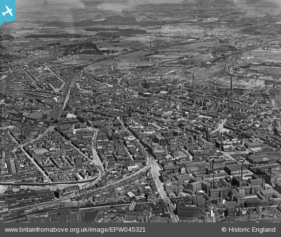
EPW045321 ENGLAND (1934). The town, Huddersfield, 1934
© Copyright OpenStreetMap contributors and licensed by the OpenStreetMap Foundation. 2026. Cartography is licensed as CC BY-SA.
Nearby Images (10)
EPW045321

EPW024366

EAW025241

EPW024367

EPW045316

EAW025243

EPW016137

EAW025240

EPW024369

EPW024368

Details
| Title | [EPW045321] The town, Huddersfield, 1934 |
| Reference | EPW045321 |
| Date | July-1934 |
| Link | |
| Place name | HUDDERSFIELD |
| Parish | |
| District | |
| Country | ENGLAND |
| Easting / Northing | 414624, 416808 |
| Longitude / Latitude | -1.7787456974668, 53.647340596923 |
| National Grid Reference | SE146168 |
Pins

RT |
Friday 22nd of April 2022 01:27:02 PM | |
|
RT |
Friday 22nd of April 2022 01:26:36 PM | |
|
RT |
Friday 22nd of April 2022 01:26:16 PM | |
|
RT |
Friday 22nd of April 2022 12:15:29 PM | |
|
Annie |
Sunday 2nd of April 2017 02:41:50 PM | |
|
Annie |
Sunday 2nd of April 2017 02:37:07 PM | |
|
john h |
Wednesday 8th of July 2015 07:46:55 PM | |
|
Stan |
Sunday 6th of April 2014 11:35:27 AM | |
|
Stan |
Sunday 6th of April 2014 11:15:10 AM | |
|
Stan |
Sunday 6th of April 2014 11:07:47 AM |