
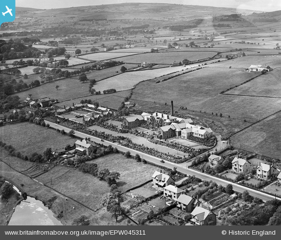
EPW045311 ENGLAND (1934). The Hartley Hospital, The Hartley Homes and surrounding countryside, Colne, from the south-east, 1934
© Copyright OpenStreetMap contributors and licensed by the OpenStreetMap Foundation. 2026. Cartography is licensed as CC BY-SA.
Nearby Images (6)
EPW045311

EPW045310

EPW045313

EPW045309

EPW045312

EPW045314

Details
| Title | [EPW045311] The Hartley Hospital, The Hartley Homes and surrounding countryside, Colne, from the south-east, 1934 |
| Reference | EPW045311 |
| Date | July-1934 |
| Link | |
| Place name | COLNE |
| Parish | COLNE |
| District | |
| Country | ENGLAND |
| Easting / Northing | 391569, 440654 |
| Longitude / Latitude | -2.1282085315705, 53.86183010082 |
| National Grid Reference | SD916407 |
Pins
Be the first to add a comment to this image!