
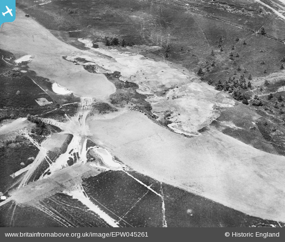
EPW045261 ENGLAND (1934). Land Drainage on Sunningdale Golf Course, Brick Hill, 1934
© Copyright OpenStreetMap contributors and licensed by the OpenStreetMap Foundation. 2026. Cartography is licensed as CC BY-SA.
Nearby Images (3)
EPW045261

EPW045255

EPW045258

Details
| Title | [EPW045261] Land Drainage on Sunningdale Golf Course, Brick Hill, 1934 |
| Reference | EPW045261 |
| Date | July-1934 |
| Link | |
| Place name | BRICK HILL |
| Parish | CHOBHAM |
| District | |
| Country | ENGLAND |
| Easting / Northing | 495390, 165400 |
| Longitude / Latitude | -0.62921879808513, 51.37912946301 |
| National Grid Reference | SU954654 |
Pins
Be the first to add a comment to this image!
User Comment Contributions
Looks like the 4th and 12th greens on the new course, from the southeast. |

Tony D |
Tuesday 2nd of July 2013 12:52:03 PM |
It's a tricky one Tony but I'm happy with the suggested NGR. We'll update the catalogue and post the new record here in due course. Yours, Katy Britain from Above Cataloguing Team Leader |
Katy Whitaker |
Tuesday 2nd of July 2013 12:52:03 PM |