
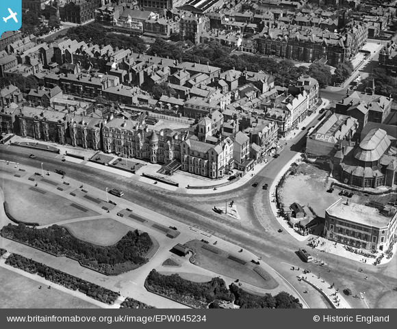
EPW045234 ENGLAND (1934). The Royal Hotel and environs, Southport, 1934
© Copyright OpenStreetMap contributors and licensed by the OpenStreetMap Foundation. 2026. Cartography is licensed as CC BY-SA.
Nearby Images (12)
EPW045234

EPW045235

EPW045239

EPW045240

EPW045238

EPW058486

EPW003011

EPW018660

EPW018659

EPW058491

EPW045236

EPW045237

Details
| Title | [EPW045234] The Royal Hotel and environs, Southport, 1934 |
| Reference | EPW045234 |
| Date | July-1934 |
| Link | |
| Place name | SOUTHPORT |
| Parish | |
| District | |
| Country | ENGLAND |
| Easting / Northing | 333257, 417184 |
| Longitude / Latitude | -3.0097891332285, 53.646666784419 |
| National Grid Reference | SD333172 |
Pins
Be the first to add a comment to this image!