
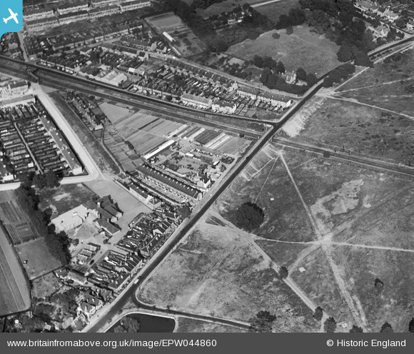
EPW044860 ENGLAND (1934). Commonside East, Beehive Bridge and environs, Mitcham, 1934
© Copyright OpenStreetMap contributors and licensed by the OpenStreetMap Foundation. 2026. Cartography is licensed as CC BY-SA.
Nearby Images (6)
EPW044860

EPW044862

EPW044864

EPW044861

EPW044863

EAW047584

Details
| Title | [EPW044860] Commonside East, Beehive Bridge and environs, Mitcham, 1934 |
| Reference | EPW044860 |
| Date | June-1934 |
| Link | |
| Place name | MITCHAM |
| Parish | |
| District | |
| Country | ENGLAND |
| Easting / Northing | 528210, 168799 |
| Longitude / Latitude | -0.1565869573049, 51.403215439021 |
| National Grid Reference | TQ282688 |
