
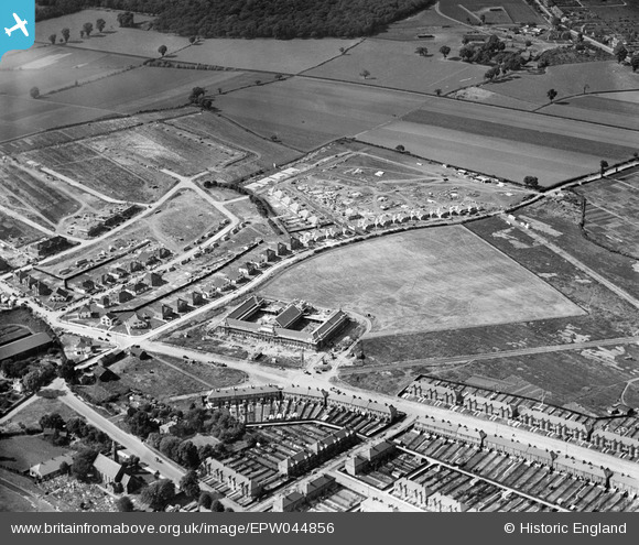
EPW044856 ENGLAND (1934). Ilford County High School and housing along Mossford Lane under construction, Barkingside, 1934
© Copyright OpenStreetMap contributors and licensed by the OpenStreetMap Foundation. 2024. Cartography is licensed as CC BY-SA.
Nearby Images (12)
EPW044856

EPW044300

EPW044854

EPW044304

EPW044299

EPW044301

EPW044859

EPW044857

EPW044858

EPW044297

EPW044303

EPW044855

Details
| Title | [EPW044856] Ilford County High School and housing along Mossford Lane under construction, Barkingside, 1934 |
| Reference | EPW044856 |
| Date | June-1934 |
| Link | |
| Place name | BARKINGSIDE |
| Parish | |
| District | |
| Country | ENGLAND |
| Easting / Northing | 543950, 190260 |
| Longitude / Latitude | 0.078330165203245, 51.592300517207 |
| National Grid Reference | TQ440903 |
Pins
 Gerard |
Wednesday 1st of February 2023 02:39:02 PM | |
Ralavendrel |
Monday 29th of December 2014 07:37:47 PM | |
Hermann the German |
Tuesday 22nd of October 2013 06:01:59 PM | |
Hermann the German |
Tuesday 22nd of October 2013 06:00:27 PM | |
Originally called Blind Lane. |
Gerard |
Wednesday 1st of February 2023 02:36:04 PM |
Hermann the German |
Tuesday 22nd of October 2013 05:59:38 PM |