
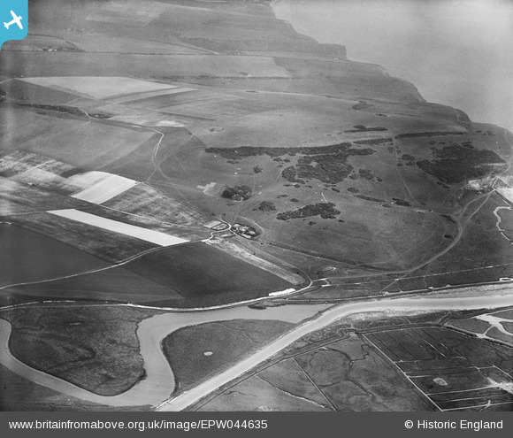
EPW044635 ENGLAND (1934). The Cuckmere River, Haven Brow and Limekiln Bottom, Cliff End, 1934
© Copyright OpenStreetMap contributors and licensed by the OpenStreetMap Foundation. 2026. Cartography is licensed as CC BY-SA.
Nearby Images (3)
EPW044635

 0°
0m
0°
0m
EPW044622
 99°
177m
99°
177m
EPW044638
 184°
204m
184°
204m
Details
| Title | [EPW044635] The Cuckmere River, Haven Brow and Limekiln Bottom, Cliff End, 1934 |
| Reference | EPW044635 |
| Date | May-1934 |
| Link | |
| Place name | CLIFF END |
| Parish | CUCKMERE VALLEY |
| District | |
| Country | ENGLAND |
| Easting / Northing | 552225, 98315 |
| Longitude / Latitude | 0.15875766255594, 50.763861429108 |
| National Grid Reference | TV522983 |
Pins
Be the first to add a comment to this image!