
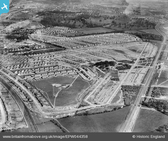
EPW044358 ENGLAND (1934). The Falconwood Park Estate under construction between Rochester Way and Westwood Lane and environs, Falconwood, 1934
© Copyright OpenStreetMap contributors and licensed by the OpenStreetMap Foundation. 2026. Cartography is licensed as CC BY-SA.
Nearby Images (5)
EPW044358

EPW044274

EPW038214

EPW044741

EPW044738

Details
| Title | [EPW044358] The Falconwood Park Estate under construction between Rochester Way and Westwood Lane and environs, Falconwood, 1934 |
| Reference | EPW044358 |
| Date | May-1934 |
| Link | |
| Place name | FALCONWOOD |
| Parish | |
| District | |
| Country | ENGLAND |
| Easting / Northing | 545543, 175268 |
| Longitude / Latitude | 0.095118443244522, 51.457166560483 |
| National Grid Reference | TQ455753 |
Pins

Anup |
Wednesday 10th of December 2025 08:04:40 AM | |
 |
Mike Floate |
Monday 23rd of December 2013 08:52:28 PM |