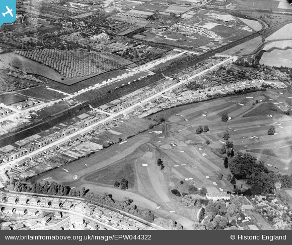
EPW044322 ENGLAND (1934). Parkside Avenue, Barnehurst Golf Course and the Bexleyheath Railway Line, Barneshurst, 1934
    © Copyright OpenStreetMap contributors and licensed by the OpenStreetMap Foundation. 2025. Cartography is licensed as CC BY-SA.
  
Details
| Title | [EPW044322] Parkside Avenue, Barnehurst Golf Course and the Bexleyheath Railway Line, Barneshurst, 1934 | 
| Reference | EPW044322 | 
| Date | May-1934 | 
| Link | |
| Place name | BARNEHURST | 
| Parish | |
| District | |
| Country | ENGLAND | 
| Easting / Northing | 551042, 176034 | 
| Longitude / Latitude | 0.17454463646493, 51.462609259465 | 
| National Grid Reference | TQ510760 | 
Pins
Be the first to add a comment to this image!
 
             
  ![[EPW044322] Parkside Avenue, Barnehurst Golf Course and the Bexleyheath Railway Line, Barneshurst, 1934](http://britainfromabove.org.uk/sites/all/libraries/aerofilms-images/public/100x100/EPW/044/EPW044322.jpg) 
  
                                          ![[EPW044323] Parkside Avenue, Barnehurst Golf Course and the Bexleyheath Railway Line, Barneshurst, 1934](http://britainfromabove.org.uk/sites/all/libraries/aerofilms-images/public/100x100/EPW/044/EPW044323.jpg) 
 ![[EPW044320] Parkside Avenue, Barnehurst Golf Course and the Bexleyheath Railway Line, Barneshurst, 1934](http://britainfromabove.org.uk/sites/all/libraries/aerofilms-images/public/100x100/EPW/044/EPW044320.jpg) 
 ![[EPW044710] The Bexleyheath Line, Parkside Avenue and Barnehurst Golf Course, Barnhurst, from the west, 1934](http://britainfromabove.org.uk/sites/all/libraries/aerofilms-images/public/100x100/EPW/044/EPW044710.jpg)