
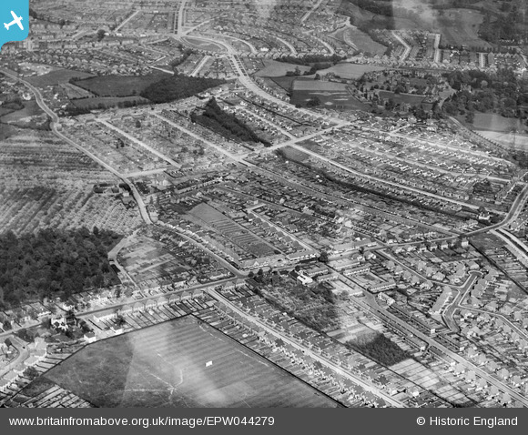
EPW044279 ENGLAND (1934). Housing development around Lamorbey Residential School and Willersley Avenue, Blackfen, 1934
© Copyright OpenStreetMap contributors and licensed by the OpenStreetMap Foundation. 2026. Cartography is licensed as CC BY-SA.
Nearby Images (4)
EPW044279

EPW044398

EPW044399

EPW044280

Details
| Title | [EPW044279] Housing development around Lamorbey Residential School and Willersley Avenue, Blackfen, 1934 |
| Reference | EPW044279 |
| Date | May-1934 |
| Link | |
| Place name | BLACKFEN |
| Parish | |
| District | |
| Country | ENGLAND |
| Easting / Northing | 545315, 173504 |
| Longitude / Latitude | 0.091114104724629, 51.441372799303 |
| National Grid Reference | TQ453735 |
Pins

currantbun |
Friday 12th of May 2023 06:12:21 PM | |
|
currantbun |
Friday 12th of May 2023 06:11:19 PM | |
|
billybuttons |
Tuesday 28th of March 2017 10:34:28 PM | |
|
Tom Burnham |
Friday 23rd of May 2014 11:50:51 PM | |
|
Tom Burnham |
Friday 23rd of May 2014 11:49:57 PM | |
|
currantbun |
Wednesday 7th of May 2014 05:55:28 PM |