
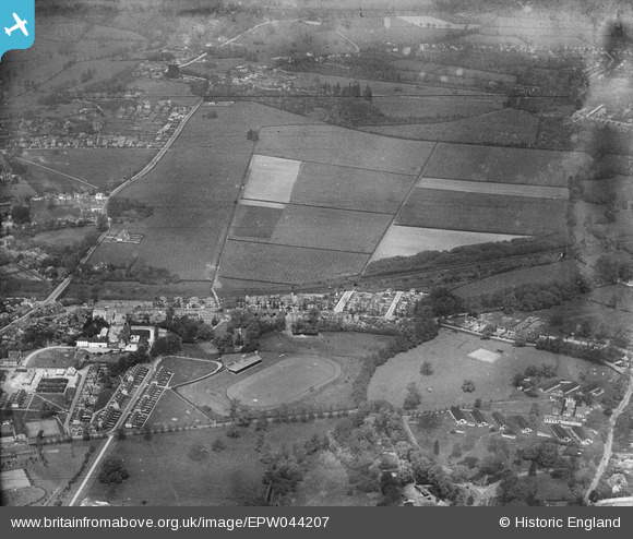
EPW044207 ENGLAND (1934). The LPTB Metropolitan Line, Honeycroft Hill and environs, Uxbridge, 1934
© Copyright OpenStreetMap contributors and licensed by the OpenStreetMap Foundation. 2024. Cartography is licensed as CC BY-SA.
Nearby Images (4)
EPW044207

EPW044509

EPW044511

EPW044495

Details
| Title | [EPW044207] The LPTB Metropolitan Line, Honeycroft Hill and environs, Uxbridge, 1934 |
| Reference | EPW044207 |
| Date | May-1934 |
| Link | |
| Place name | UXBRIDGE |
| Parish | |
| District | |
| Country | ENGLAND |
| Easting / Northing | 506431, 184576 |
| Longitude / Latitude | -0.46483980372192, 51.549546087663 |
| National Grid Reference | TQ064846 |
Pins
 Dawnb |
Sunday 1st of September 2013 06:01:52 PM |