
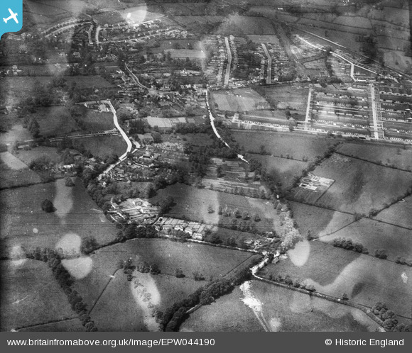
EPW044190 ENGLAND (1934). Austin's Lane, Glebe Avenue and the LPTB Metropolitan Line, Ickenham, 1934
© Copyright OpenStreetMap contributors and licensed by the OpenStreetMap Foundation. 2026. Cartography is licensed as CC BY-SA.
Nearby Images (3)
EPW044190

EPW034668

EPW044501

Details
| Title | [EPW044190] Austin's Lane, Glebe Avenue and the LPTB Metropolitan Line, Ickenham, 1934 |
| Reference | EPW044190 |
| Date | May-1934 |
| Link | |
| Place name | ICKENHAM |
| Parish | |
| District | |
| Country | ENGLAND |
| Easting / Northing | 508323, 185967 |
| Longitude / Latitude | -0.43713185990155, 51.561689759457 |
| National Grid Reference | TQ083860 |
Pins

tizer |
Monday 4th of May 2020 10:14:26 AM | |
|
Chris |
Tuesday 28th of April 2020 09:45:45 AM | |
|
Chris |
Tuesday 28th of April 2020 09:44:06 AM | |
|
Chris |
Friday 2nd of June 2017 10:43:56 PM | |
|
Chris |
Friday 2nd of June 2017 10:42:15 PM | |
|
Chris |
Friday 2nd of June 2017 10:39:53 PM |