
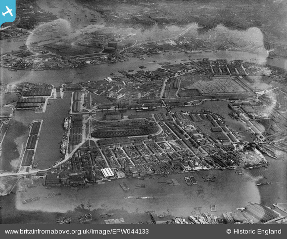
EPW044133 ENGLAND (1934). West India Docks, Millwall Docks and environs, Isle of Dogs, 1934
© Copyright OpenStreetMap contributors and licensed by the OpenStreetMap Foundation. 2026. Cartography is licensed as CC BY-SA.
Nearby Images (5)
EPW044133

EAW021721

EAW112904

EPW044132

EAW009803

Details
| Title | [EPW044133] West India Docks, Millwall Docks and environs, Isle of Dogs, 1934 |
| Reference | EPW044133 |
| Date | May-1934 |
| Link | |
| Place name | ISLE OF DOGS |
| Parish | |
| District | |
| Country | ENGLAND |
| Easting / Northing | 537784, 179466 |
| Longitude / Latitude | -0.014862062288947, 51.496836593103 |
| National Grid Reference | TQ378795 |
Pins

moses72 |
Saturday 5th of April 2014 06:24:03 PM | |
|
Scrape |
Saturday 22nd of February 2014 11:29:08 PM |