
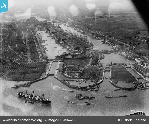
EPW044122 ENGLAND (1934). The Royal Group of Docks, East Ham, from the south-east, 1934
© Copyright OpenStreetMap contributors and licensed by the OpenStreetMap Foundation. 2026. Cartography is licensed as CC BY-SA.
Nearby Images (18)
EPW044122

EAW046498

EPW044125

EPW044117

EPW024898

EAW046497

EAW000036

EPW032931

EPW044115

EAW008729

EAW008731

EPW032929

EAW008736

EAW029489

EAW008737

EAW008733

EAW008730

EAW008732

Details
| Title | [EPW044122] The Royal Group of Docks, East Ham, from the south-east, 1934 |
| Reference | EPW044122 |
| Date | May-1934 |
| Link | |
| Place name | EAST HAM |
| Parish | |
| District | |
| Country | ENGLAND |
| Easting / Northing | 544168, 180264 |
| Longitude / Latitude | 0.077378680861138, 51.502415643966 |
| National Grid Reference | TQ442803 |
Pins
Be the first to add a comment to this image!