
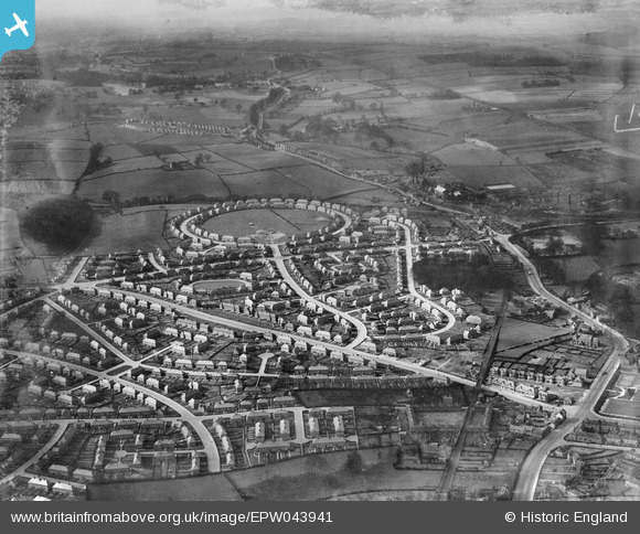
EPW043941 ENGLAND (1934). Housing at Amesbury Circus, Dulverton Vale and Broxtowe Lane, Cinderhill, from the south-east, 1934
© Copyright OpenStreetMap contributors and licensed by the OpenStreetMap Foundation. 2026. Cartography is licensed as CC BY-SA.
Nearby Images (4)
EPW043941

EPW043598

EPW043942

EPW043943

Details
| Title | [EPW043941] Housing at Amesbury Circus, Dulverton Vale and Broxtowe Lane, Cinderhill, from the south-east, 1934 |
| Reference | EPW043941 |
| Date | April-1934 |
| Link | |
| Place name | CINDERHILL |
| Parish | |
| District | |
| Country | ENGLAND |
| Easting / Northing | 453810, 342952 |
| Longitude / Latitude | -1.1984558800641, 52.980896915827 |
| National Grid Reference | SK538430 |
Pins

Rob |
Monday 5th of September 2022 11:26:08 PM | |
|
NorthChurch |
Monday 27th of April 2020 01:04:17 PM | |
|
NorthChurch |
Monday 27th of April 2020 01:03:18 PM | |
|
NorthChurch |
Monday 27th of April 2020 01:02:21 PM | |
|
NorthChurch |
Monday 27th of April 2020 01:01:35 PM | |
|
NorthChurch |
Monday 27th of April 2020 01:00:27 PM | |
|
Dave |
Monday 2nd of February 2015 08:26:42 PM | |
|
Hillary |
Friday 25th of April 2014 09:51:34 PM |