
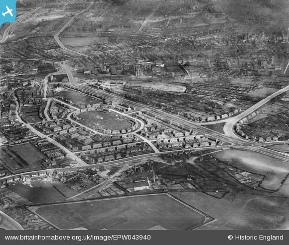
EPW043940 ENGLAND (1934). The Newcastle Colliery and housing at Bracknell Crescent and the Western Boulevard, Whitemoor, 1934
© Copyright OpenStreetMap contributors and licensed by the OpenStreetMap Foundation. 2026. Cartography is licensed as CC BY-SA.
Nearby Images (10)
EPW043940

EPW043939

EPW043611

EPW043609

EPW043937

EPW043610

EPW043936

EPW043607

EPW038035

EPW043938

Details
| Title | [EPW043940] The Newcastle Colliery and housing at Bracknell Crescent and the Western Boulevard, Whitemoor, 1934 |
| Reference | EPW043940 |
| Date | April-1934 |
| Link | |
| Place name | WHITEMOOR |
| Parish | |
| District | |
| Country | ENGLAND |
| Easting / Northing | 454948, 342317 |
| Longitude / Latitude | -1.1816141695403, 52.975073208255 |
| National Grid Reference | SK549423 |
Pins

Sarah |
Sunday 7th of July 2013 10:32:57 PM |