
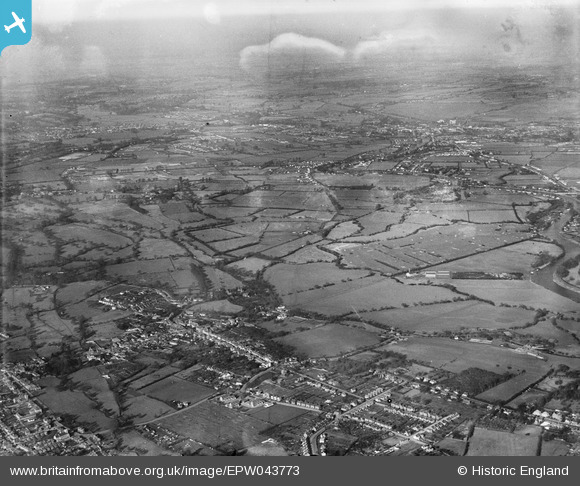
EPW043773 ENGLAND (1934). The town and surrounding countryside, Chertsey, from the south, 1934
© Copyright OpenStreetMap contributors and licensed by the OpenStreetMap Foundation. 2026. Cartography is licensed as CC BY-SA.
Nearby Images (4)
EPW043773

EPW043772

EPW049553

EPW049548

Details
| Title | [EPW043773] The town and surrounding countryside, Chertsey, from the south, 1934 |
| Reference | EPW043773 |
| Date | February-1934 |
| Link | |
| Place name | CHERTSEY |
| Parish | |
| District | |
| Country | ENGLAND |
| Easting / Northing | 504372, 167268 |
| Longitude / Latitude | -0.49964122952276, 51.394341344508 |
| National Grid Reference | TQ044673 |
