
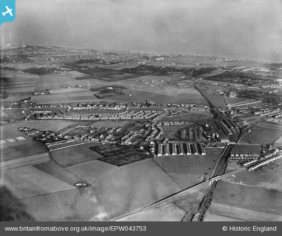
EPW043753 ENGLAND (1934). Northwood, Ramsgate railway station and environs, Ramsgate, from the south-west, 1934
© Copyright OpenStreetMap contributors and licensed by the OpenStreetMap Foundation. 2026. Cartography is licensed as CC BY-SA.
Nearby Images (2)
EPW043753

EAW009040
 under construction, Ramsgate, 1947")
Details
| Title | [EPW043753] Northwood, Ramsgate railway station and environs, Ramsgate, from the south-west, 1934 |
| Reference | EPW043753 |
| Date | February-1934 |
| Link | |
| Place name | NORTHWOOD |
| Parish | RAMSGATE |
| District | |
| Country | ENGLAND |
| Easting / Northing | 636640, 165846 |
| Longitude / Latitude | 1.3981896097667, 51.341853217673 |
| National Grid Reference | TR366658 |
Pins

Stephen Godden |
Tuesday 10th of March 2026 04:18:55 PM | |
|
Cylouk |
Monday 19th of January 2026 03:12:44 PM | |
|
John Maddams |
Thursday 27th of November 2025 02:42:08 PM | |
|
John Maddams |
Thursday 27th of November 2025 02:40:45 PM | |
|
Rambler |
Tuesday 7th of February 2017 09:34:08 PM | |
|
Rambler |
Tuesday 7th of February 2017 09:32:35 PM |
