
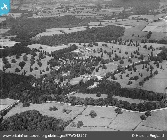
EPW043197 ENGLAND (1933). Grantley Hall, Grantley, 1933
© Copyright OpenStreetMap contributors and licensed by the OpenStreetMap Foundation. 2025. Cartography is licensed as CC BY-SA.
Nearby Images (6)
EPW043196

EPW043197

EPW043200

EPW043198

EPW043199

EPW043201

Details
| Title | [EPW043197] Grantley Hall, Grantley, 1933 |
| Reference | EPW043197 |
| Date | September-1933 |
| Link | |
| Place name | GRANTLEY HALL |
| Parish | GRANTLEY |
| District | |
| Country | ENGLAND |
| Easting / Northing | 424200, 469400 |
| Longitude / Latitude | -1.6297138986073, 54.119718897964 |
| National Grid Reference | SE242694 |
Pins
Be the first to add a comment to this image!