
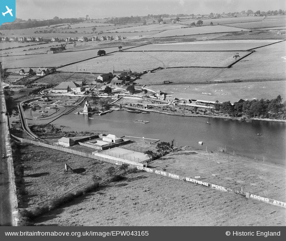
EPW043165 ENGLAND (1933). Golden Acre Park Estate, Leeds, 1933
© Copyright OpenStreetMap contributors and licensed by the OpenStreetMap Foundation. 2026. Cartography is licensed as CC BY-SA.
Nearby Images (19)
EPW043165

EPW043166

EPW043167

EPW045301

EPW045296

EPW045302

EPW043162

EPW043163

EPW043164

EPW043159

EPW043161

EPW045298

EAW037590

EPW045297

EPW045300

EPW045299

EAW037587

EAW037588

EAW037589

Details
| Title | [EPW043165] Golden Acre Park Estate, Leeds, 1933 |
| Reference | EPW043165 |
| Date | September-1933 |
| Link | |
| Place name | GOLDEN ACRE PARK |
| Parish | |
| District | |
| Country | ENGLAND |
| Easting / Northing | 426800, 441600 |
| Longitude / Latitude | -1.5923802214661, 53.869709960598 |
| National Grid Reference | SE268416 |
Pins
Be the first to add a comment to this image!