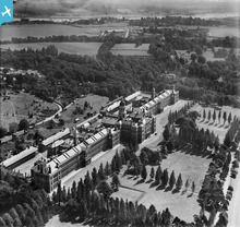
EPW042964 ENGLAND (1933). The Royal Victoria Hospital, Hamble-le-Rice, 1933
© Copyright OpenStreetMap contributors and licensed by the OpenStreetMap Foundation. 2026. Cartography is licensed as CC BY-SA.
Details
| Title | [EPW042964] The Royal Victoria Hospital, Hamble-le-Rice, 1933 |
| Reference | EPW042964 |
| Date | August-1933 |
| Link | |
| Place name | HAMBLE-LE-RICE |
| Parish | HOUND |
| District | |
| Country | ENGLAND |
| Easting / Northing | 446422, 107662 |
| Longitude / Latitude | -1.3402629848291, 50.866040381956 |
| National Grid Reference | SU464077 |
Pins

Class31 |
Saturday 21st of March 2015 05:06:53 PM |
User Comment Contributions
This is not Hamble-le-rice, it is Netley Abbey. |

34051 |
Thursday 29th of December 2016 12:53:44 PM |
Royal Victoria Country Park, Netley, 20/03/2015 |

Class31 |
Saturday 21st of March 2015 05:07:41 PM |
The Chapel, Royal Victoria Country Park, Netley, 20/03/2015 |

Class31 |
Saturday 21st of March 2015 05:03:23 PM |
The Chapel, Royal Victoria Country Park, Netley, 20/03/2015 |

Class31 |
Saturday 21st of March 2015 05:03:01 PM |
The British Army’s first purpose-built hospital, The Queen Victoria Hospital was built 1856-1863. Until 1902, the hospital housed the Army Medical School and treated thousands of wounded servicemen in the Second Boer War, First World War and Second World War. In 1963, a fire destroyed part of the main building and the hospital was demolished in 1966 with only the chapel being retained. |

Dan Gregory |
Tuesday 3rd of June 2014 08:33:46 PM |


![[EPW042964] The Royal Victoria Hospital, Hamble-le-Rice, 1933](http://britainfromabove.org.uk/sites/all/libraries/aerofilms-images/public/100x100/EPW/042/EPW042964.jpg)
![[EPW042965] The Royal Victoria Hospital, Hamble-le-Rice, 1933](http://britainfromabove.org.uk/sites/all/libraries/aerofilms-images/public/100x100/EPW/042/EPW042965.jpg)
![[EPW009063] The Royal Victoria Hospital, Netley, 1923](http://britainfromabove.org.uk/sites/all/libraries/aerofilms-images/public/100x100/EPW/009/EPW009063.jpg)
