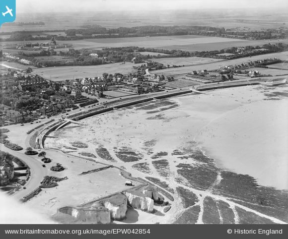
EPW042854 ENGLAND (1933). Westgate Bay, Westgate-on-Sea, 1933
© Copyright OpenStreetMap contributors and licensed by the OpenStreetMap Foundation. 2026. Cartography is licensed as CC BY-SA.
Details
| Title | [EPW042854] Westgate Bay, Westgate-on-Sea, 1933 |
| Reference | EPW042854 |
| Date | August-1933 |
| Link | |
| Place name | WESTGATE-ON-SEA |
| Parish | |
| District | |
| Country | ENGLAND |
| Easting / Northing | 631853, 170143 |
| Longitude / Latitude | 1.3323749082326, 51.38240208581 |
| National Grid Reference | TR319701 |
Pins

LoonzM |
Friday 12th of April 2024 10:56:08 PM | |

carruthers |
Saturday 29th of January 2022 05:08:07 PM |


![[EPW042854] Westgate Bay, Westgate-on-Sea, 1933](http://britainfromabove.org.uk/sites/all/libraries/aerofilms-images/public/100x100/EPW/042/EPW042854.jpg)
![[EPW035476] Westgate Bay and the town, Westgate-on-Sea, from the north-west, 1931](http://britainfromabove.org.uk/sites/all/libraries/aerofilms-images/public/100x100/EPW/035/EPW035476.jpg)
![[EPW042857] Ledge Point, The Gardens and Sea Road, Westgate-on-Sea, 1933](http://britainfromabove.org.uk/sites/all/libraries/aerofilms-images/public/100x100/EPW/042/EPW042857.jpg)