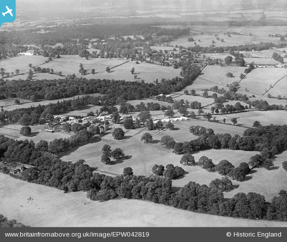
EPW042819 ENGLAND (1933). The Greyhound Racing Association Hook Kennels, Northaw, from the south-east, 1933
© Copyright OpenStreetMap contributors and licensed by the OpenStreetMap Foundation. 2025. Cartography is licensed as CC BY-SA.
Details
| Title | [EPW042819] The Greyhound Racing Association Hook Kennels, Northaw, from the south-east, 1933 |
| Reference | EPW042819 |
| Date | August-1933 |
| Link | |
| Place name | NORTHAW |
| Parish | NORTHAW AND CUFFLEY |
| District | |
| Country | ENGLAND |
| Easting / Northing | 528017, 201044 |
| Longitude / Latitude | -0.14762460479058, 51.693069331028 |
| National Grid Reference | TL280010 |
Pins

Ray Flack |
Tuesday 29th of July 2014 04:21:19 PM | |

Ray Flack |
Tuesday 29th of July 2014 04:19:21 PM | |

Ray Flack |
Tuesday 29th of July 2014 04:17:04 PM | |

Ray Flack |
Tuesday 29th of July 2014 04:15:19 PM | |

Ray Flack |
Tuesday 29th of July 2014 04:14:11 PM | |

Ray Flack |
Tuesday 29th of July 2014 04:13:16 PM |


![[EPW042819] The Greyhound Racing Association Hook Kennels, Northaw, from the south-east, 1933](http://britainfromabove.org.uk/sites/all/libraries/aerofilms-images/public/100x100/EPW/042/EPW042819.jpg)
![[EPW042817] The Greyhound Racing Association Hook Kennels, Northaw, 1933](http://britainfromabove.org.uk/sites/all/libraries/aerofilms-images/public/100x100/EPW/042/EPW042817.jpg)
![[EPW042821] The Greyhound Racing Association Hook Kennels, Northaw, 1933](http://britainfromabove.org.uk/sites/all/libraries/aerofilms-images/public/100x100/EPW/042/EPW042821.jpg)