
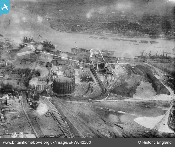
EPW042160 ENGLAND (1933). Beckton Gas Light and Coke Company and environs, Beckton, 1933
© Copyright OpenStreetMap contributors and licensed by the OpenStreetMap Foundation. 2026. Cartography is licensed as CC BY-SA.
Nearby Images (19)
EPW042160

EPW042159

EPW037095

EPW042156

EPW036773

EPW037100

EPW042158

EPW037097

EPW037101

EPW042157

EPW037098

EPW037099

EPW037094

EPW037093

EPW037161

EPW037157

EPW037159

EPW037158

EPW037160

Details
| Title | [EPW042160] Beckton Gas Light and Coke Company and environs, Beckton, 1933 |
| Reference | EPW042160 |
| Date | July-1933 |
| Link | |
| Place name | BECKTON |
| Parish | |
| District | |
| Country | ENGLAND |
| Easting / Northing | 544214, 181247 |
| Longitude / Latitude | 0.078443100274722, 51.511237710668 |
| National Grid Reference | TQ442812 |
Pins
Be the first to add a comment to this image!