
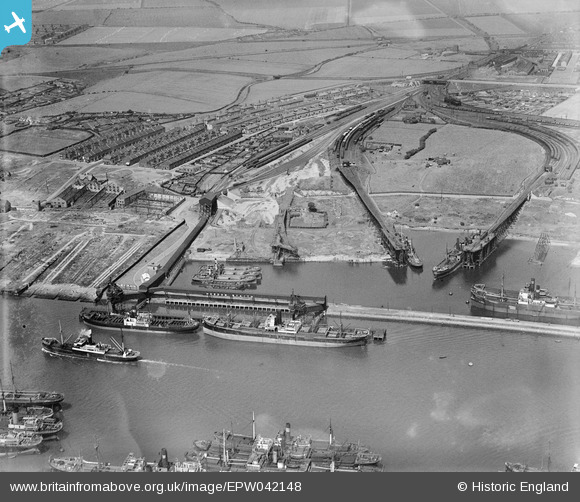
EPW042148 ENGLAND (1933). Hartley Main Collieries Ltd at Howdon and Cramlington Staithes, East Howdon, 1933
© Copyright OpenStreetMap contributors and licensed by the OpenStreetMap Foundation. 2026. Cartography is licensed as CC BY-SA.
Nearby Images (6)
EPW042148

EPW042150

EPW042153

EPW042151

EPW042152

EPW042149

Details
| Title | [EPW042148] Hartley Main Collieries Ltd at Howdon and Cramlington Staithes, East Howdon, 1933 |
| Reference | EPW042148 |
| Date | July-1933 |
| Link | |
| Place name | EAST HOWDON |
| Parish | |
| District | |
| Country | ENGLAND |
| Easting / Northing | 433491, 566279 |
| Longitude / Latitude | -1.4765240831466, 54.98989903233 |
| National Grid Reference | NZ335663 |
Pins
Be the first to add a comment to this image!