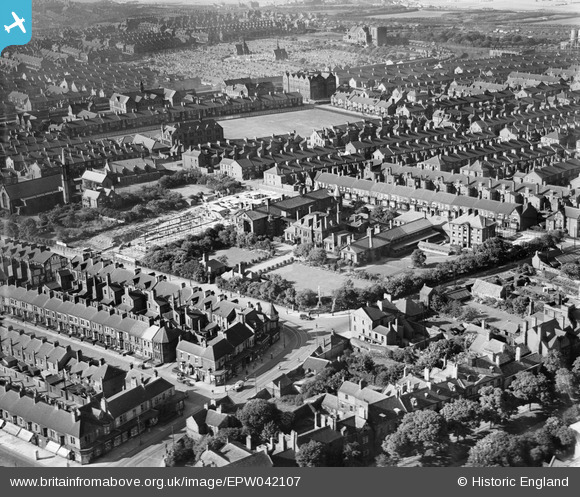
EPW042107 ENGLAND (1933). Ingham Infirmary and environs, South Shields, from the south-west, 1933
© Copyright OpenStreetMap contributors and licensed by the OpenStreetMap Foundation. 2025. Cartography is licensed as CC BY-SA.
Nearby Images (6)
Details
| Title | [EPW042107] Ingham Infirmary and environs, South Shields, from the south-west, 1933 |
| Reference | EPW042107 |
| Date | June-1933 |
| Link | |
| Place name | SOUTH SHIELDS |
| Parish | |
| District | |
| Country | ENGLAND |
| Easting / Northing | 437017, 566047 |
| Longitude / Latitude | -1.4214444551613, 54.987564488118 |
| National Grid Reference | NZ370660 |
Pins
 DAVIDB |
Thursday 12th of September 2024 08:04:26 PM |


![[EPW042107] Ingham Infirmary and environs, South Shields, from the south-west, 1933](http://britainfromabove.org.uk/sites/all/libraries/aerofilms-images/public/100x100/EPW/042/EPW042107.jpg)
![[EPW042108] Ingham Infirmary and environs, South Shields, 1933](http://britainfromabove.org.uk/sites/all/libraries/aerofilms-images/public/100x100/EPW/042/EPW042108.jpg)
![[EPW042103] Ingham Infirmary and environs, South Shields, 1933](http://britainfromabove.org.uk/sites/all/libraries/aerofilms-images/public/100x100/EPW/042/EPW042103.jpg)
![[EPW042104] Ingham Infirmary and environs, South Shields, 1933](http://britainfromabove.org.uk/sites/all/libraries/aerofilms-images/public/100x100/EPW/042/EPW042104.jpg)
![[EPW042106] Ingham Infirmary and environs, South Shields, 1933](http://britainfromabove.org.uk/sites/all/libraries/aerofilms-images/public/100x100/EPW/042/EPW042106.jpg)
![[EPW042105] Ingham Infirmary and environs, South Shields, 1933](http://britainfromabove.org.uk/sites/all/libraries/aerofilms-images/public/100x100/EPW/042/EPW042105.jpg)