
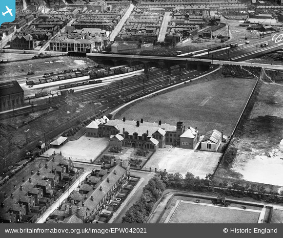
EPW042021 ENGLAND (1933). School on Westminster Street (now the site of Bury College), Bury, 1933
© Copyright OpenStreetMap contributors and licensed by the OpenStreetMap Foundation. 2026. Cartography is licensed as CC BY-SA.
Nearby Images (9)
EPW042021
, Bury, 1933")
EPW048661

EPW048659

EPW048645

EPW047507

EPW047497

EPW046166

EPW046162

EPW046161

Details
| Title | [EPW042021] School on Westminster Street (now the site of Bury College), Bury, 1933 |
| Reference | EPW042021 |
| Date | June-1933 |
| Link | |
| Place name | BURY |
| Parish | |
| District | |
| Country | ENGLAND |
| Easting / Northing | 380455, 410203 |
| Longitude / Latitude | -2.2952911573813, 53.587806438125 |
| National Grid Reference | SD805102 |
Pins

muso2001 |
Friday 4th of December 2020 05:13:56 PM | |
|
muso2001 |
Friday 4th of December 2020 05:12:39 PM |