
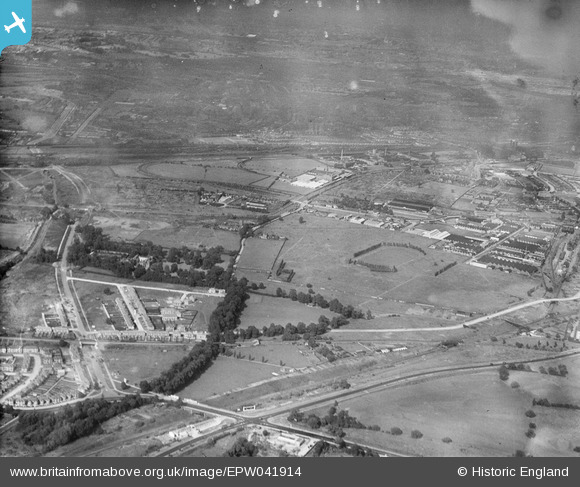
EPW041914 ENGLAND (1933). The Horse Ring football ground and various factories, Park Royal, from the south-west, 1933
© Copyright OpenStreetMap contributors and licensed by the OpenStreetMap Foundation. 2026. Cartography is licensed as CC BY-SA.
Nearby Images (6)
EPW041914

EPW041911

EPW041912

EPW041913

EPW041910

EPW041848

Details
| Title | [EPW041914] The Horse Ring football ground and various factories, Park Royal, from the south-west, 1933 |
| Reference | EPW041914 |
| Date | June-1933 |
| Link | |
| Place name | PARK ROYAL |
| Parish | |
| District | |
| Country | ENGLAND |
| Easting / Northing | 518881, 182749 |
| Longitude / Latitude | -0.28596024036562, 51.530638078921 |
| National Grid Reference | TQ189827 |
Pins

Leslie B |
Tuesday 18th of December 2018 04:04:17 PM | |
|
The Laird |
Thursday 12th of January 2017 06:40:07 PM | |
|
The Laird |
Thursday 12th of January 2017 06:38:43 PM | |

Class31 |
Wednesday 19th of August 2015 09:09:48 AM | |
|
colsouth111 |
Friday 21st of June 2013 05:12:46 PM | |
It's Twyford Abbey to me too. |
Class31 |
Wednesday 19th of August 2015 09:11:21 AM |